Select Your Route Profile
AI-Native Navigation For Real
Navigation that actually understands you, your vehicle, and the roads you drive on
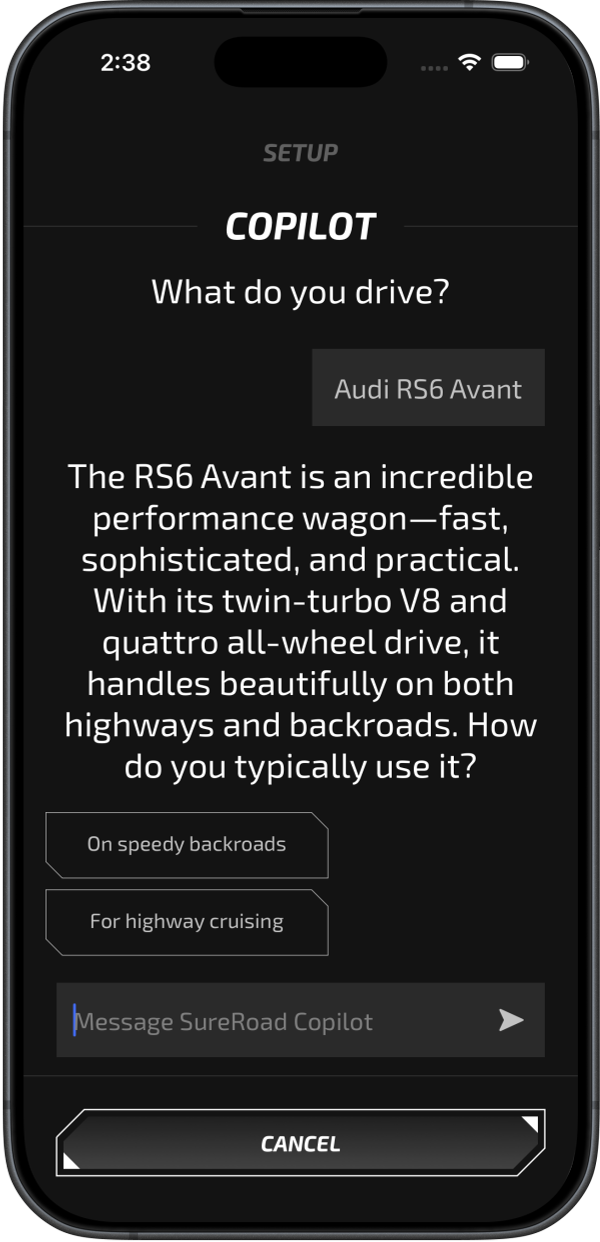
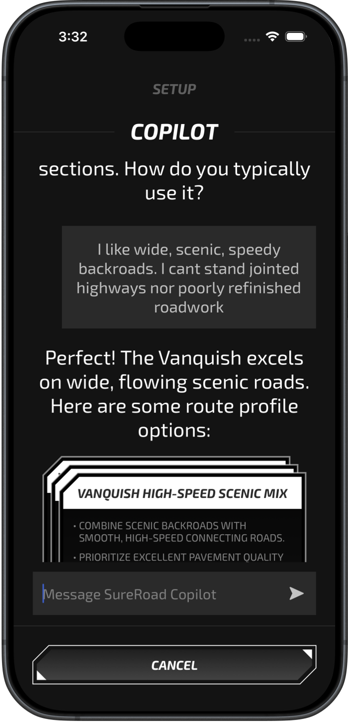
Create Your Profile
Tell SureRoad about your vehicle and driving preferences.
-
Our AI uses our in-house built Road Intelligence Engine with comprehensive, real-time road knowledge to:
- Calculate every unique constraint for your vehicle and driving style, creating a road profile tailored to you
- Generate a purpose-built map for each profile that marks all relevant roads
- Switch between profiles instantly for different vehicles
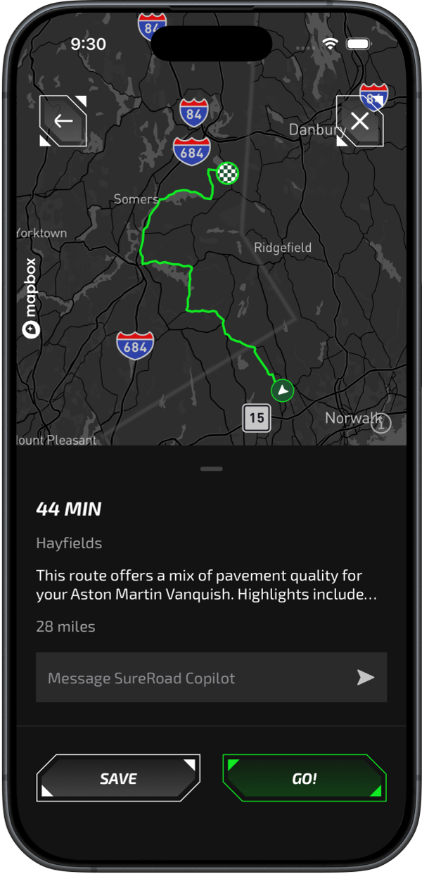
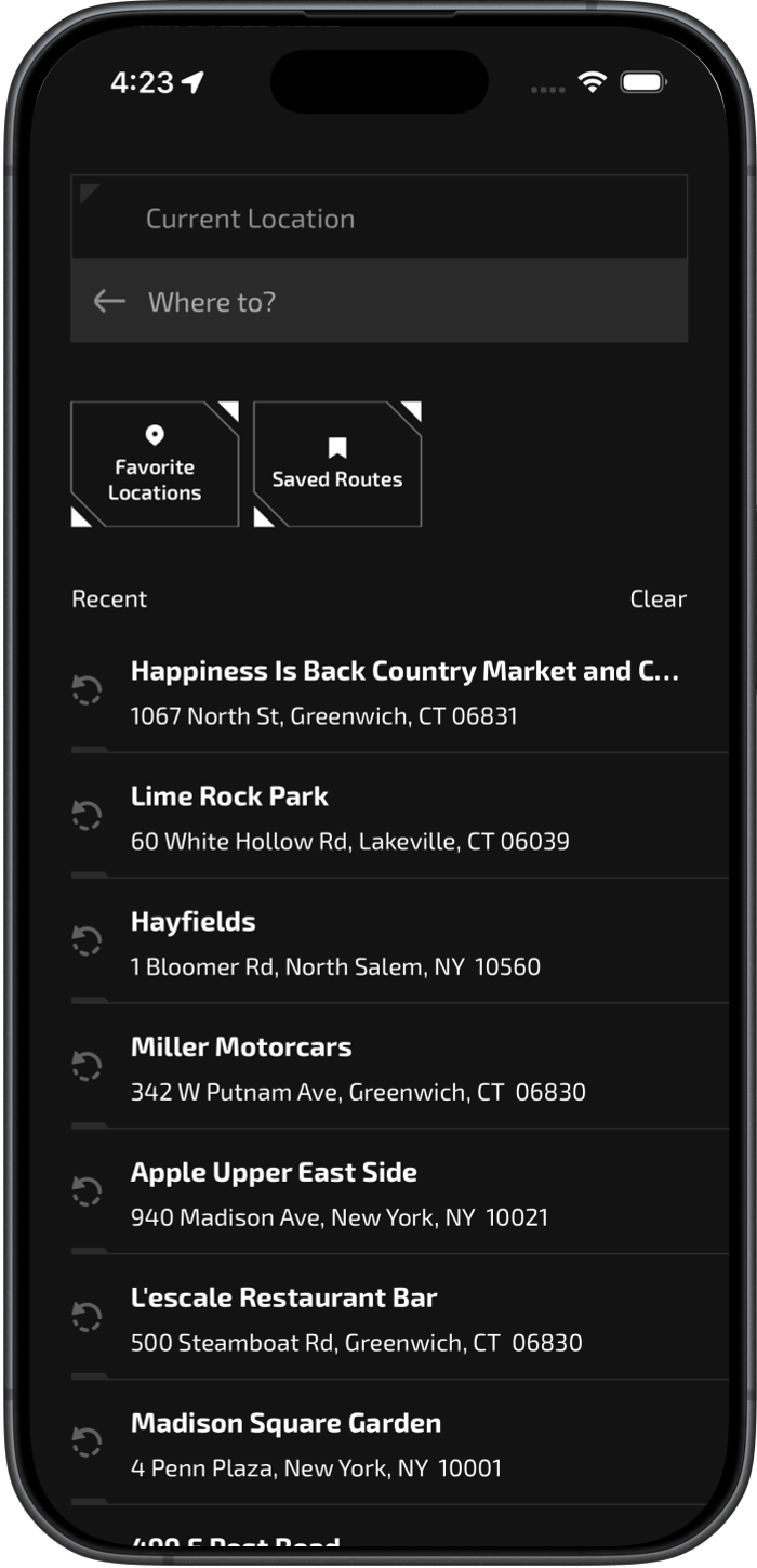
Build Your Route
Search any destination and let SureRoad craft your perfect route.
- Our AI instructs our in-house built routing system to weigh every road based on your profile's custom map
- Can factor in lane width, surface quality, clearances, visibility, traffic demographics, or whatever else your vehicle and situation require
- Generates the optimal route specifically for your profile
- No waypoints to manage — your preferences are built into the route itself, so changes recalculate instantly
- Works seamlessly on iPhone and CarPlay
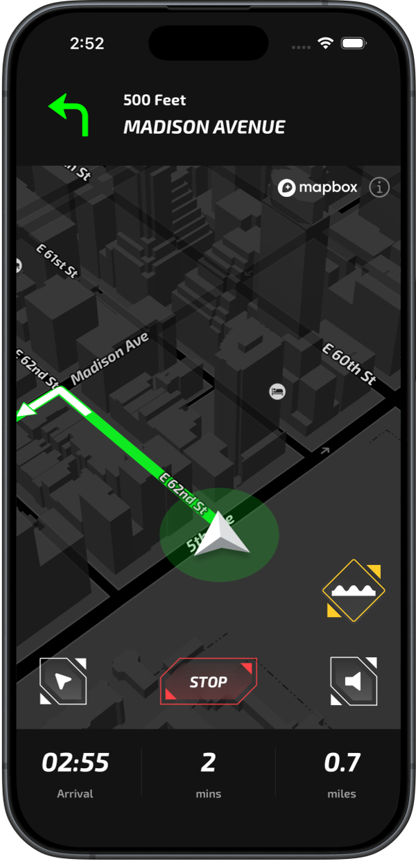
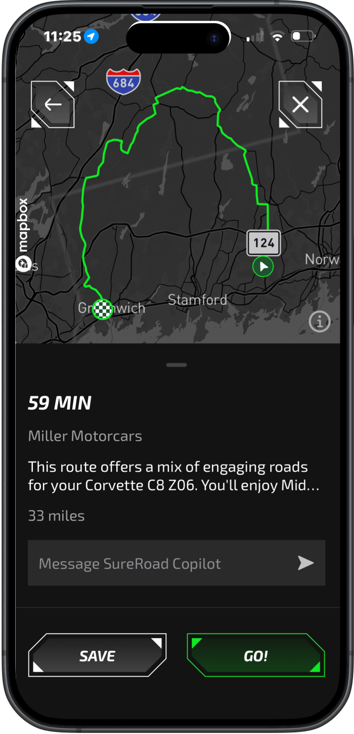
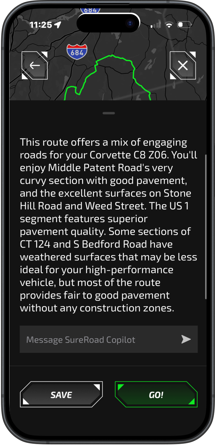
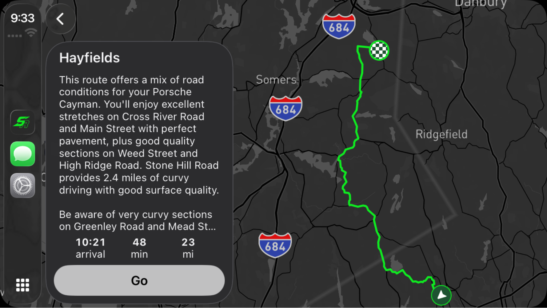
Preview Your Route
Before you drive, see exactly what your route entails.
- Complete breakdown of road conditions as they pertain to your routing profile
- Potential challenges and hazards are identified and carefully explained upfront
- Full transparency on how the route aligns with your preferences
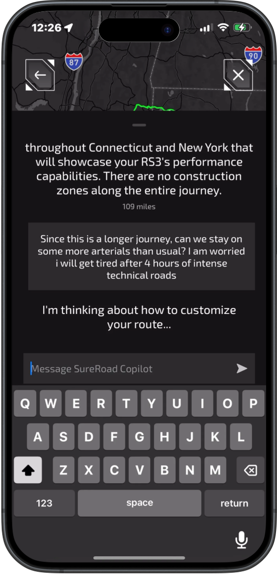
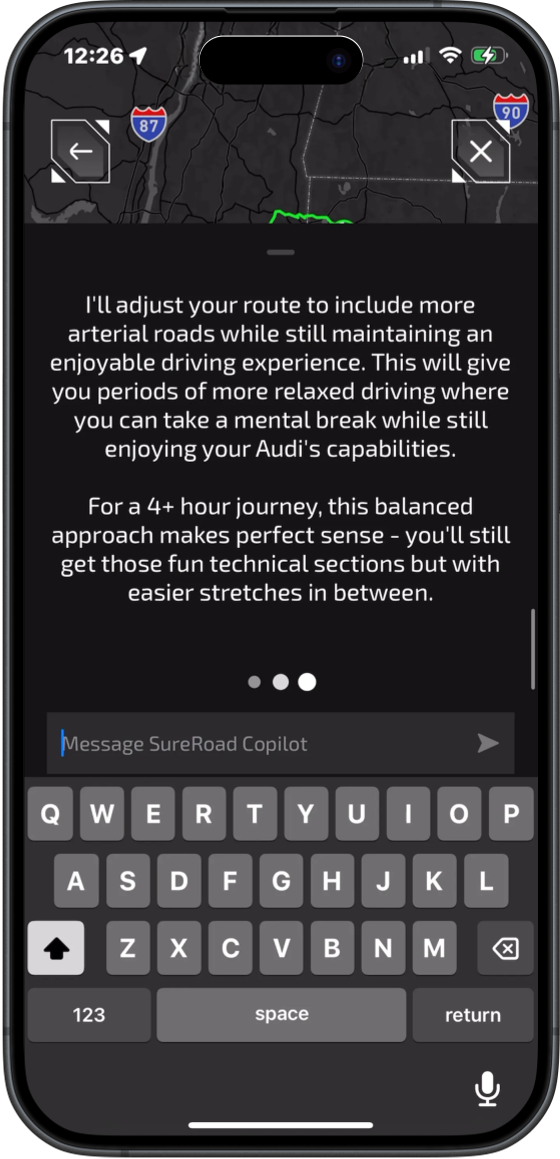
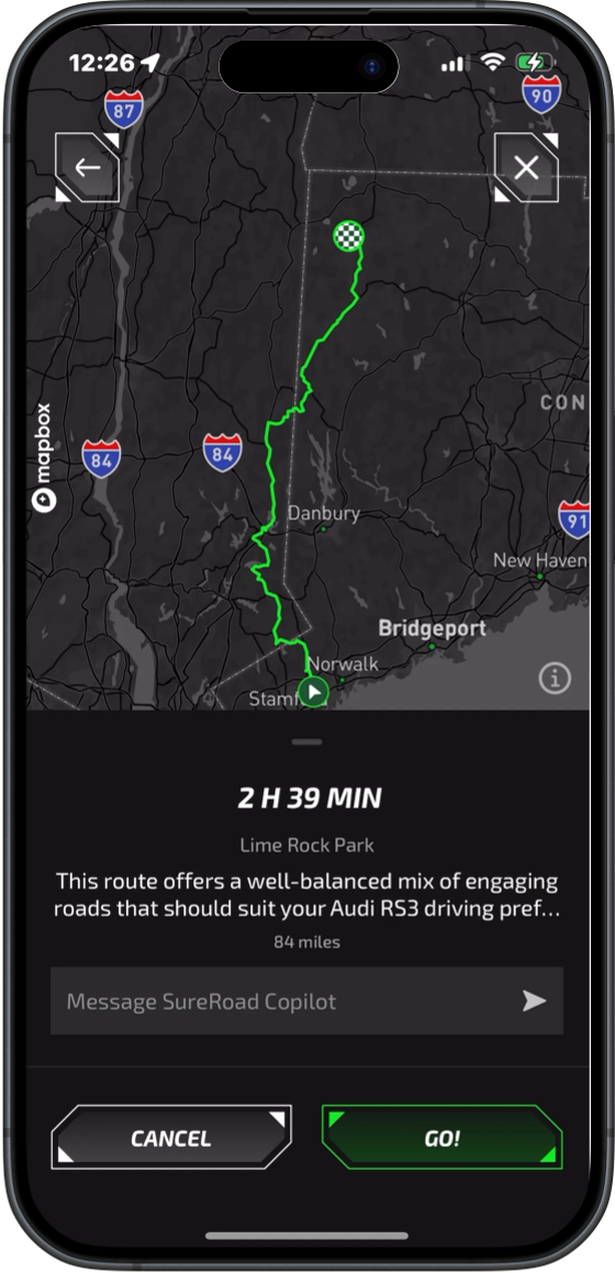
Fine-Tune Every Detail
- Avoid specific roads or even entire regions (such as NYC or Manhattan)
- Change route characteristics on the fly — shorter route, specific ETA, more backroads, detours through particular roads, and more
- AI instantly recalculates and regenerates your route
See It In Action
Try our interactive demo to experience how SureRoad creates a custom map for your profile.
Choose a profile to start the demo
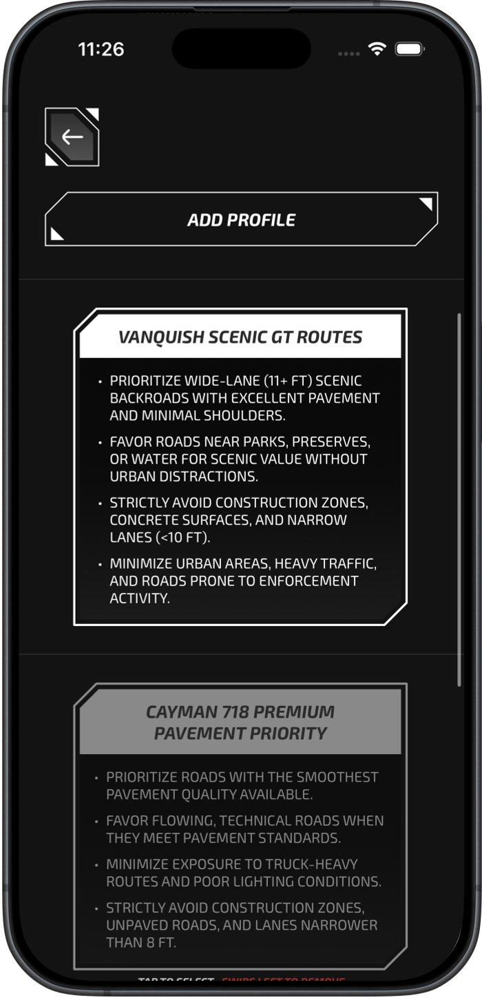
The Weekend Trail Cruiser
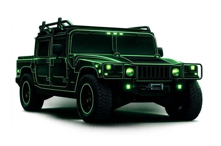
Hummer H1

The Backroad Enthusiast
Porsche Cayman 718

The Scenic GT Driver
Aston Martin Vanquish
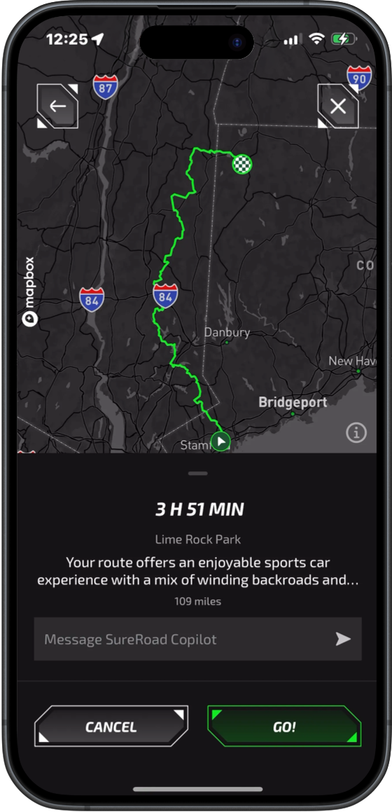
Your Route is Ready
Your personalized road network has been created. Every route you take will now be optimized for your vehicle and preferences.
Experience SureRoad Navigation on CarPlay
Discover More
The Technology
Dive deep into our Road Intelligence Engine and learn how we create AI-generated maps on demand.
Explore TechnologyAutonomous Future
Learn how our Road Intelligence Engine will power the next generation of autonomous vehicles.
Explore FutureMaps Generated On-Demand To Solve Problems
Static Layers
Pre-computed layers. Limited user segmentation. Can only display predefined criteria to users.
Generated Layers
Our Road Intelligence Engine interprets relationships between descriptive data, roads, spaces and more to deliver precise insights tailored to your specific needs.
Watch the Intelligence Engine In Action
We asked our engine to find, match, and visualize all significant repaving events in New Canaan, Connecticut since 2020. Here's how it works.
Find and show me all the roads that have been repaved in the town of New Canaan since 2020
Recursive Search
The engine searches multiple authoritative sources—town DPW records, CTDOT announcements, utility company filings—using iterative queries to find all repaving events.
Precision Matching
Each event is matched to exact road segments using mileposts, cross streets, pavement width, lane counts, and guardrail presence—any detail that adds match confidence.
Visual Mapping
Matched segments are rendered on the map with color-coded overlays showing project type, contractor, and completion status at a glance.
Built for AI from the Ground Up
Our road database is engineered specifically to be queryable by AI. Every route is properly named, indexed precisely by mileposts, with no overlapping route lines or conflicting data. This clean architecture means an AI can work through the network with clear instructions—no ambiguity, no confusion, just precise answers.
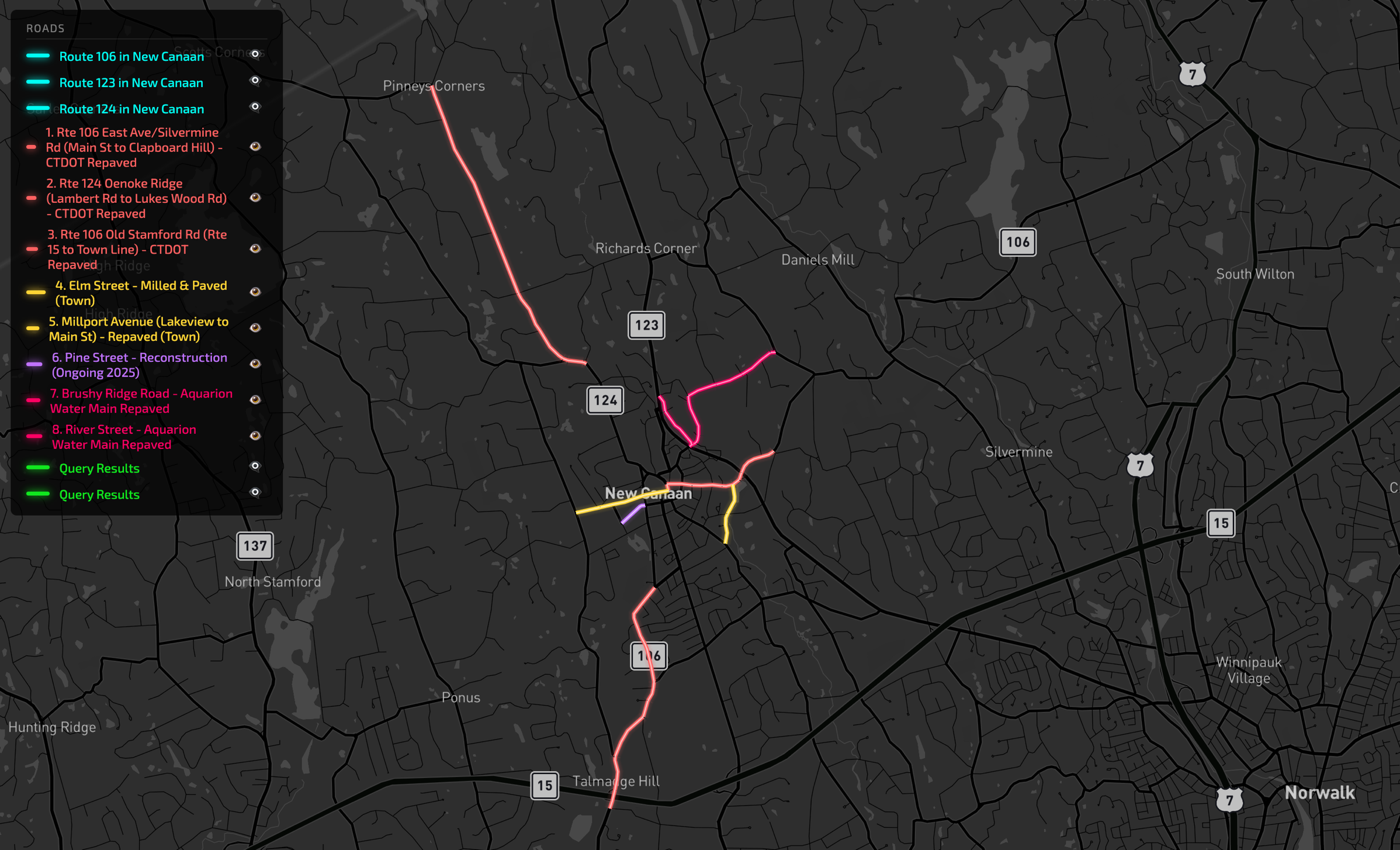
8 Separate Projects Found Across Multiple Sources
The engine searched town DPW records, CTDOT announcements, and Aquarion utility filings—then matched each event to exact road segments. What would take a human 30 minutes of cross-referencing happened in seconds—and unlike a spreadsheet, this data is now queryable, visualizable, and connected to the road network.
3 CTDOT State Route Projects
Routes 106 & 124 • ~4.8 miles total3 Town Municipal Projects
Elm St, Millport Ave, Pine St2 Utility-Related Repaving
Brushy Ridge Rd, River St • Aquarion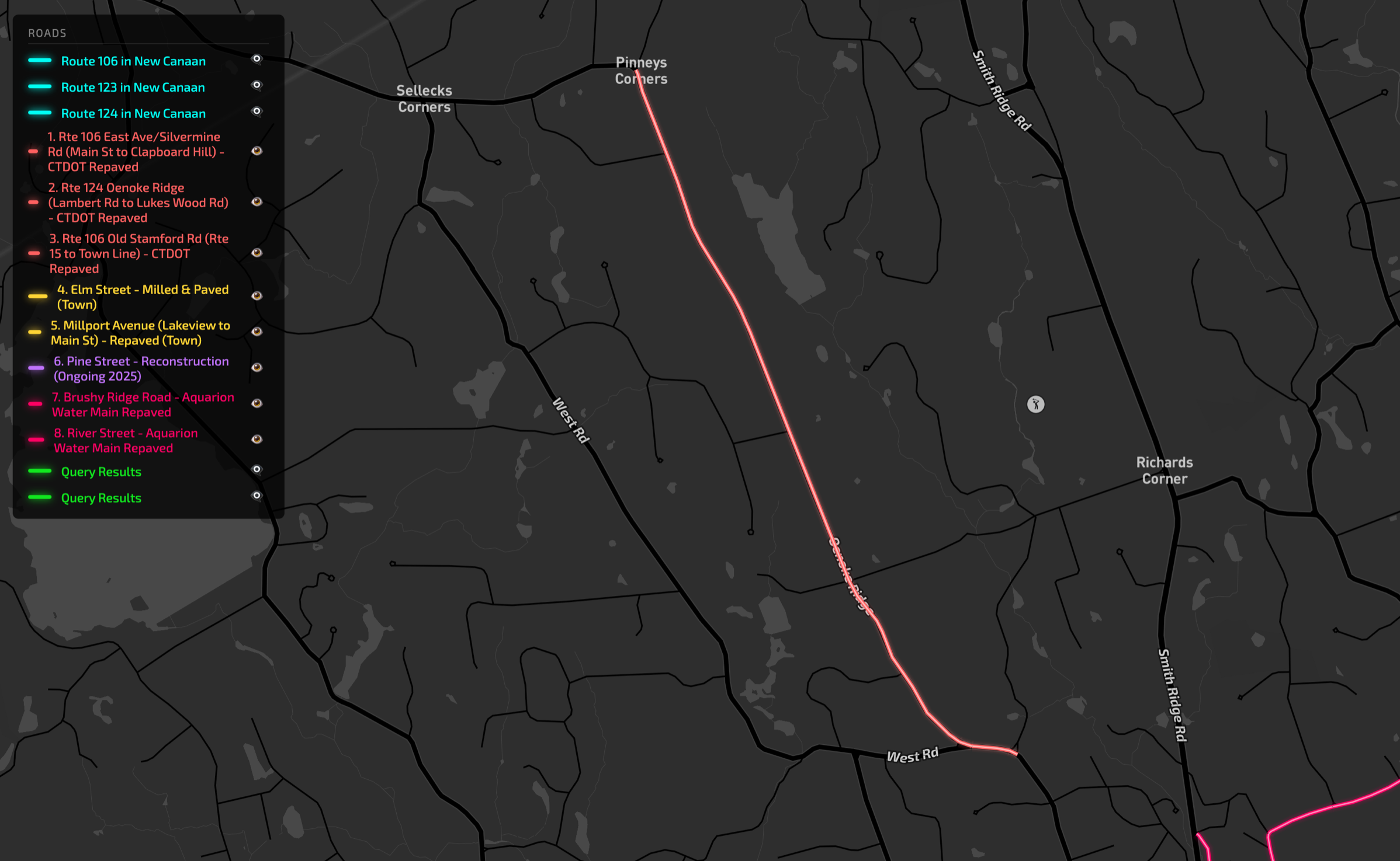
Route 124 Oenoke Ridge: Matched to Exact Mileposts
The source said "Oenoke Ridge from Lambert Road to Lukes Wood Road." The engine cross-referenced our base network to find the exact mileposts: MP 6.24 to MP 8.47—a 2.23-mile segment.
The engine used cross-street lookups to confirm: Lambert Rd intersects at MP 6.24, Lukes Wood Rd at MP 8.47. This precision lets us know exactly which portion of your route has fresh pavement.
Route 124-N • MP 6.24 – 8.47
CTDOT Milling & Paving • Completed 2024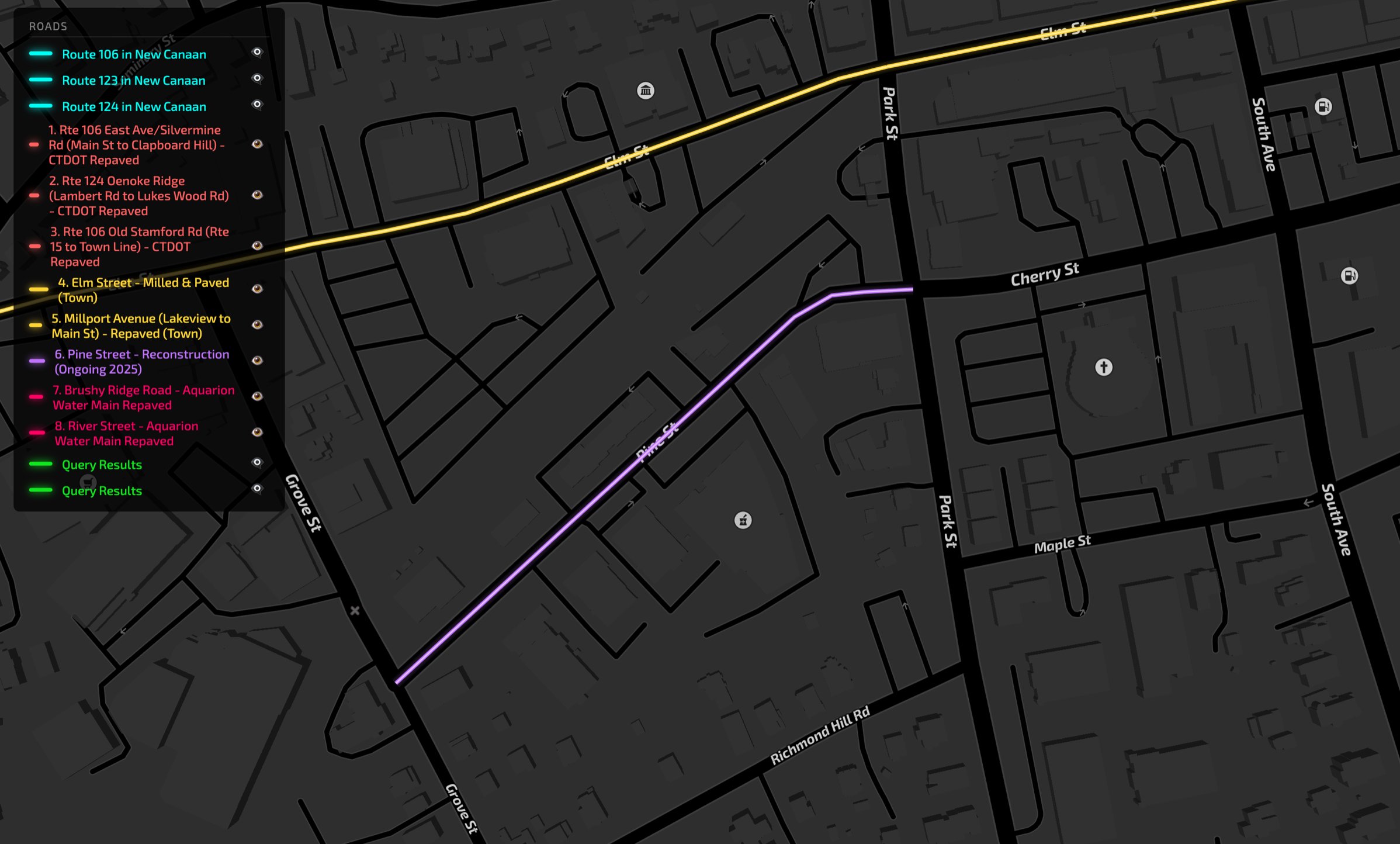
Downtown: Different Contractors, Different Statuses
The engine distinguishes between completed town projects (Elm St), ongoing reconstruction (Pine St with brick sidewalks), and state routes—each from different sources with different completion dates.
Elm Street – Milled & Paved
Town Project • Full extent • CompletedPine Street – Reconstruction
Brick sidewalks, granite curbing • OngoingMillport Ave (Lakeview to Main)
Sidewalk + Repaving • 0.28 mi • CompletedPine Street is flagged as ongoing (2025)—the engine tracks project status so you know what's still under construction vs. completed.
Narrowing Project Scope with Descriptive Data
A CTDOT press release mentions guardrail improvements along a large section of Route 37. But where will the actual lane closures happen? The engine uses our descriptive data to pinpoint the exact zones.
CTDOT Press Release
"Metal Beam Guiderail Upgrade" project on Route 37 with lane closures expected
Descriptive Data Analysis
Query shoulder widths, median types, barrier presence, lane counts across the route
3 Precise Impact Zones
Instead of the entire route, only these specific segments will see construction
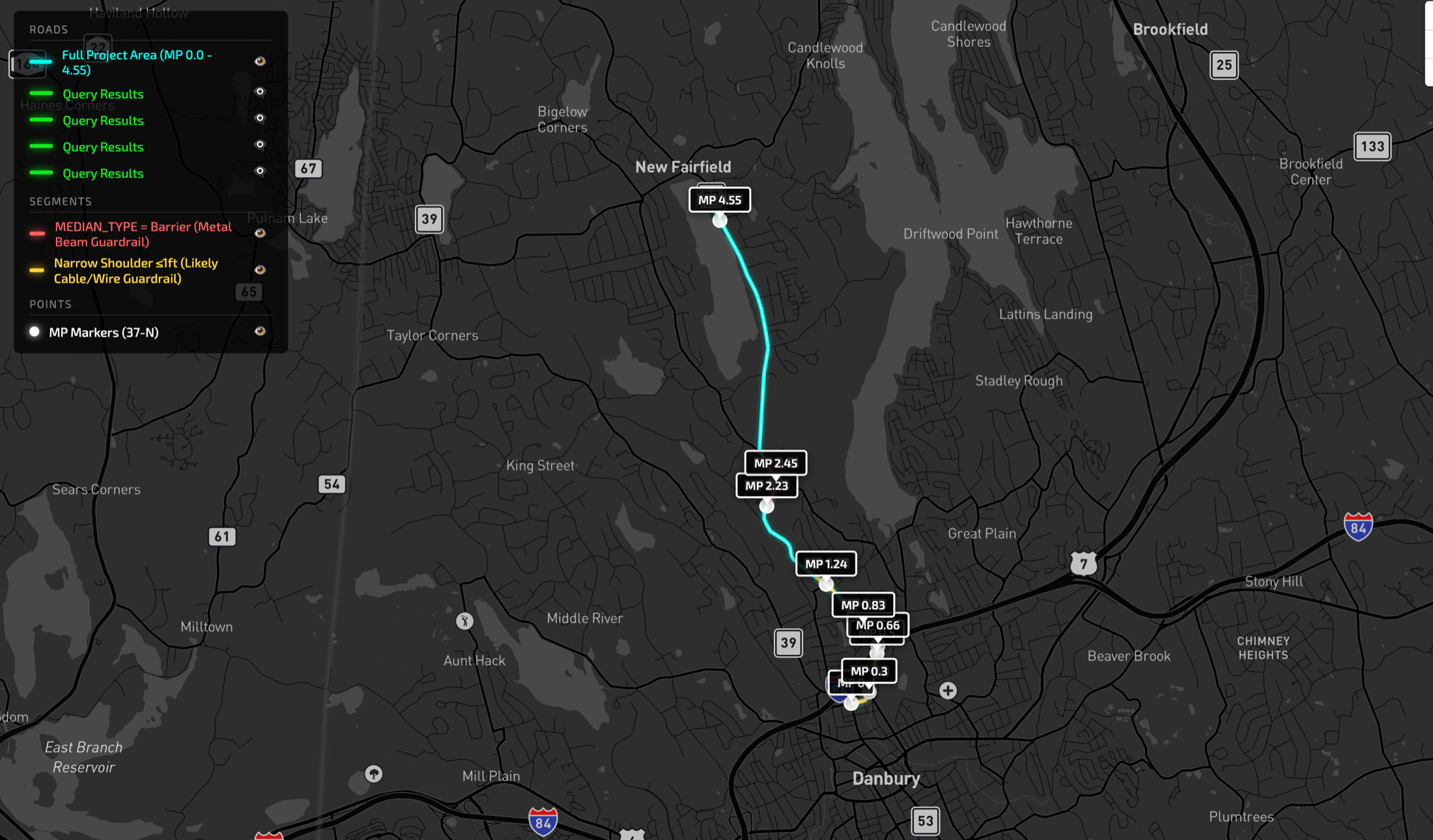
Route 37 Overview
The press release covers a large stretch of Route 37. But guardrail work can only happen where guardrails exist or are needed.
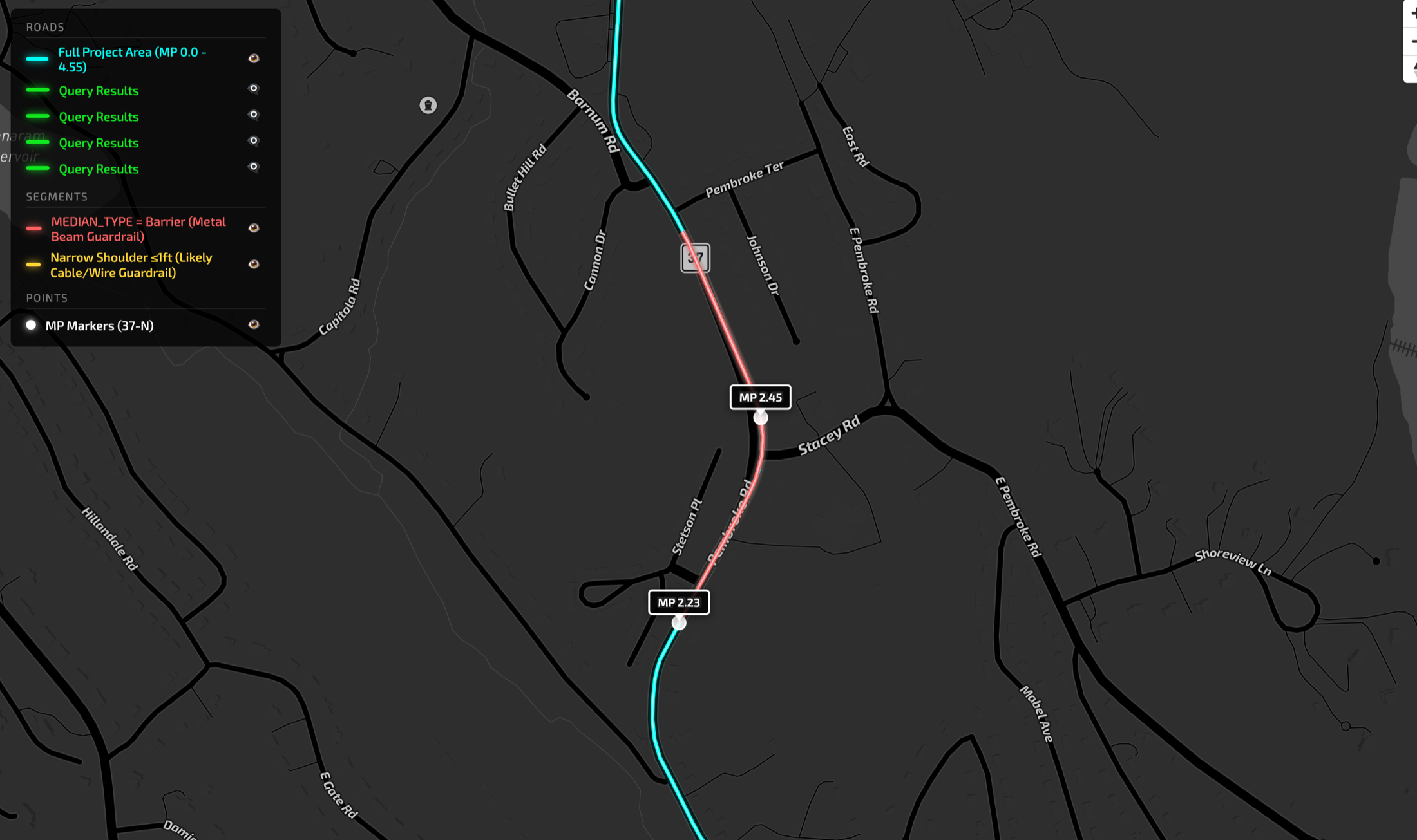
MP 2.23 – 2.45: Metal Beam Guardrail
Median type = "Barrier" in our data. Wider shoulders (4-6 ft) with proper guardrail installation. This section will see upgrade work.
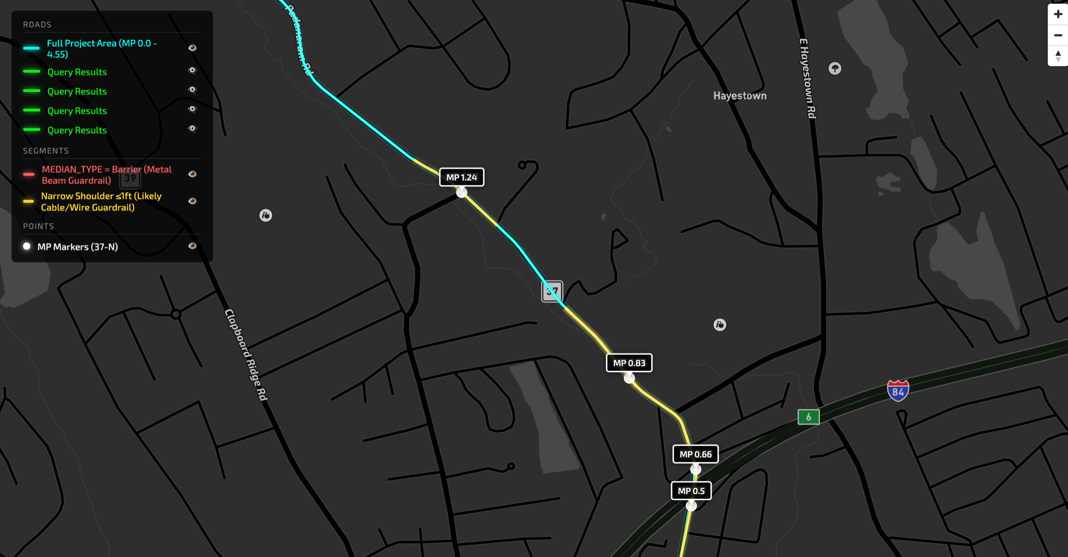
MP 0.5 – 0.87: Cable/Wire Guardrail Likely
5-lane road with only 1 ft shoulders? That's guardrail-constrained. These sections likely have cable guardrails being upgraded to metal beam.
The Key Insight
A wide state route with no shoulder at all strongly indicates some kind of barrier system. Combine that with median type data, and we can identify exactly which segments will be impacted—turning a vague "Route 37 construction" announcement into 3 specific zones that actually affect your drive.
A Self-Improving System
This is a recursive, self-improving process. Every piece of data that gets matched and added to our intelligence layer becomes additional context for future matches. The more the engine learns about New Canaan's road network—mileposts, cross-street patterns, typical project scopes—the more accurately it can match new events. More data in → better matches out.
How Our AI Generates Maps for Routing Profiles
Watch how our Road Intelligence Engine reasons through our data to generate and build custom elements.
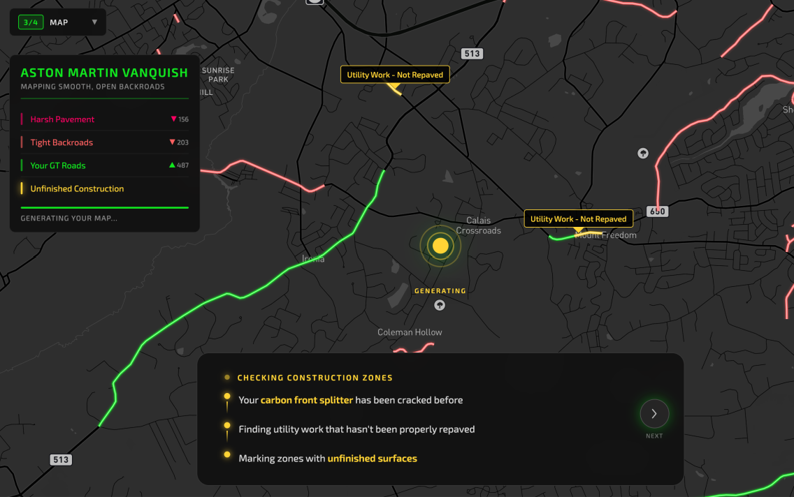
Unfinished Utility Work
For a grand tourer with a carbon fiber front splitter, unfinished road surfaces from utility work can cause expensive damage. Here's how the AI calculated this layer:
Query the Road Intelligence Engine for all utility work performed on roads in Passaic, Morris, and Bergen counties in the past two years
Cross-reference each affected road segment to check if it has been repaved since the utility work
Mark all roads that haven't been repaved as "pavement potentially includes unfinished roadwork scars"
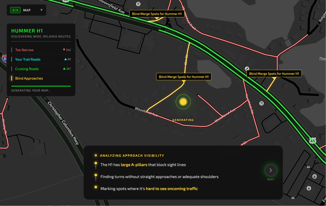
Blind Merge Spots
The Hummer H1's large A-pillars create significant blind spots. Combined with its 86" width, certain intersections become challenging. Here's how the AI calculated this layer:
Find all roads with at most two lanes and narrow lane width (10 feet or less) with no shoulder
Filter to roads that approach their intersection at a right angle or sharp curve where visibility side-to-side would be challenging
Mark spots where a large vehicle like the H1 cannot peek into the merge before fully committing
The Difference
Traditional maps cannot interpret requests and process them this way. They can only display predefined criteria. SureRoad's Road Intelligence Engine reasons through relationships between road attributes, historical data, and vehicle specifications to generate layers that have never existed before - on demand, for each user.
The Autonomous Future
Traditional mapping and navigation fails specialty vehicles today. It will also fail the autonomous future. AVs need more than what they can see - they need deep road intelligence to anticipate what's beyond the sensor range.
What AVs Can't See Coming
Garbage Day Patterns
Sensors can't predict which streets will have garbage trucks blocking lanes on Tuesday mornings.
Flood-Prone Routes
After heavy rain, certain underpasses flood every time - but there's no sign until it's too late.
Snow Plow Priorities
Some roads get plowed first, others wait for hours. No sensor can know a municipality's plow schedule.
SureRoad's Road Intelligence Engine
Our AI doesn't just map roads - it understands them. Deep intelligence about conditions, patterns, temporal events, and contextual relationships gives AVs the foresight their sensors can't provide.
Building for the Future
The same intelligence engine that powers personalized navigation for specialty vehicles today will power the autonomous fleets of tomorrow. We're building the road understanding layer that AVs will need.
Enterprise Solutions Coming Soon